
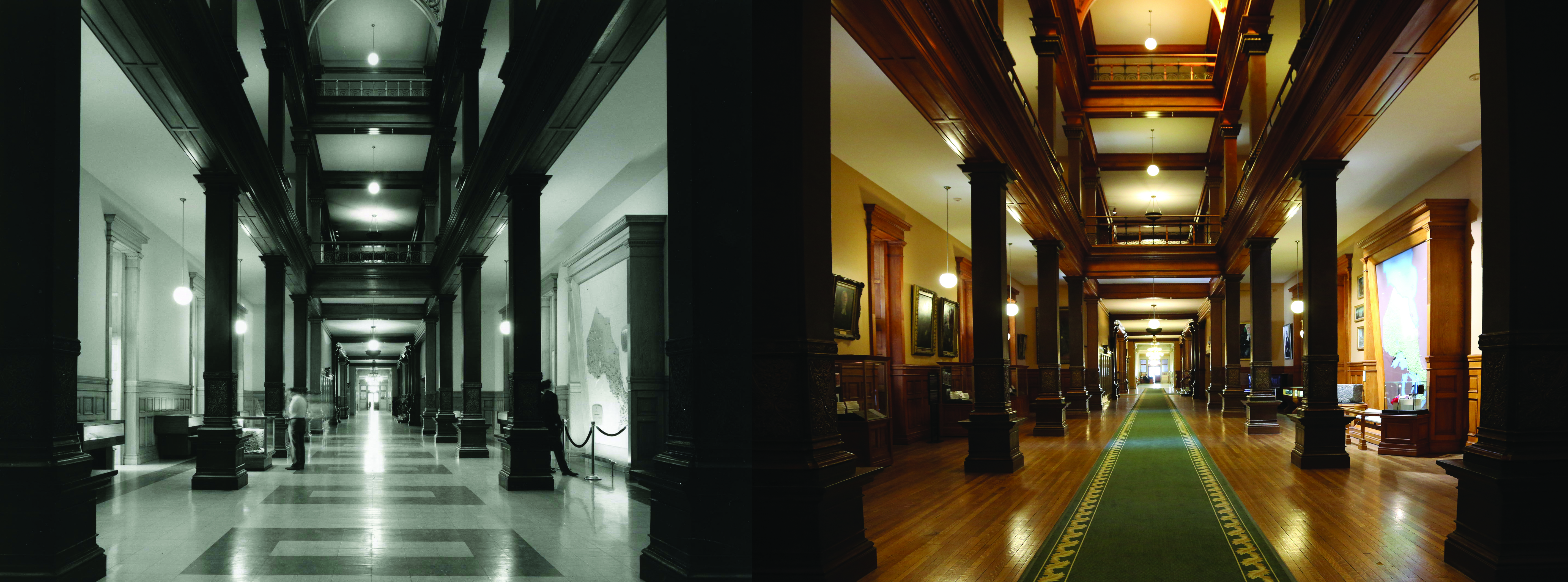
The Ontario map was installed in 1967 and since then, the map itself and the area around it have been updated – including the nickel ore moving from the south side of the hall to the north side. You will also see the addition of the Speaker’s portraits lining the walls in the 2015 photo.
The linoleum flooring was not around much longer after this photo was taken. In the late 1960s, red carpeting was laid over the linoleum, which remained in place until 1999 when the original oak floors were uncovered.